More evidence of recent dinosaur activity


In the previous post, we put forward some arguments backed with evidence that the layered strata found around the world and used by defenders of the conventional paradigm to back their theories may have been deposited rapidly rather than over the course of hundreds of millions of years.

If this theory is correct, it would undermine the widely-held belief that the giant reptiles whose fossils were first called "dinosaurs" in the 1800s must necessarily have perished at least 60 million years ago. As we noted in the previous post, the coelacanth was previously assumed to have lived between 400 million and 70 million years ago, and to have become extinct at the end of the so-called "Upper Cretaceous" period (66 million years ago) -- that is, until living coelacanths were discovered in ordinary modern settings.

We have also noted that soft tissues in recently-discovered Tyrannosaurus legbones are causing conventional theorists to rethink their paradigm. Unfortunately, they do not seem to be rethinking the paradigm that the strata that held the leg-bones can be confidently dated to 68 million years ago, but rather their previous assumptions that soft tissues such as red blood cells cannot survive for more than thousands of years (and certainly not millions of years).

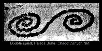
We cannot help but point out that artifacts discovered in the Americas, where civilizations remained largely undisturbed by the aggressive Roman Empire and its descendants for many centuries, seem to depict examples of creatures that we would easily identify as dinosaurs. Some of these artifacts depicting strange creatures were apparently noticed by the European intruders who began interacting with the civilizations of the Americas in the 1500s -- long before fossils found in England began to be associated with ancient giant reptiles in the 1820s, or the term "dinosaur" was coined in the 1840s.

Some of the more infamous of these alleged artifacts include the Ica Stones of Peru and the Acambaro figurines of Mexico. These finds have been dismissed as hoaxes, and I am not personally prepared to "fall on my sword" (as we used to say in the Army) to declare their authenticity. However, we have already noted the very common tendency of the defenders of the conventional paradigm to dismiss any anomalous evidence as a hoax (see here and here), which may be warranted when there are only one or two outlying data points but which becomes a little hard to accept when it is resorted to over and over and over again.

Finally, note the photograph above, which appears to indicate that T. Rex was fond of surfboards (whether certain shapes or colors of board were particularly attractive is not yet known). This would appear to be conclusive evidence that current theories need to be reworked. It also suggests that one should always check the area for signs of any Tyrannosaurs prior to a session (I always do).

The Strata and the Great Flood


The previous blog post cited an ancient Hindu text that correctly recorded the fact that the Vale of Kashmir was once a large lake or inland sea, as well as the fact that this inland sea housed a monster that ate people. The authors of the text either knew or correctly guessed that the Kashmir Valley had once held water, long before science confirmed the fact.

To even mention the possibility that such a creature, as well as the more famous creatures alleged to dwell in the inland lakes in the mountainous regions of Scotland (the lochs), could be descendents of ancient marine reptiles trapped inside large bodies of water is of course to invite scoffers and ridicule, but let's ask why such a possibility should invite ridicule. It invites ridicule not because nobody believes that enormous ancient reptiles ever existed: their existence in the past is fairly widely accepted. It invites ridicule because the last of the enormous ancient reptiles are assumed to have perished around 66 million years ago. Let's have a look at the foundation of this assumption.

The foundation of the assumption that this or that species became extinct x-number of million years ago rests upon the bedrock uniformitarian principle of the geologic column, or the stratigraphic column (or the science of "stratigraphy"). Stratigraphy is the process of naming the different layers of generally sedimentary material found around the world, and giving those layers dates based on a certain model of earth's ancient past.

The process of naming and dating these layers took place during the early 1800s, and continued through the rest of the nineteenth century. The model that is taught today has changed somewhat since then, and a few of the older names have been discarded and replaced with newer ones, but the major divisions and naming convention remains fairly consistent and should be at least casually familiar to most readers. It begins with the Pre-Cambrian period (supposedly stretching from 4.6 billion years ago all the way up to 542 million years ago) and proceeds as follows:
  • Cambrian period (542 million years ago to 488 million years ago)
  • Ordovician period (488 million years ago to 443 million years ago)
  • Silurian period (443 million years ago to 416 million years ago)
  • Devonian period (416 million years ago to 359 million years ago)
  • Carboniferous period (359 million years ago to 299 million years ago)
  • Permian period (299 million years ago to 251 million years ago)
  • Triassic period (251 million years ago to 200 million years ago)
  • Jurassic period (200 million years ago to 146 million years ago)
  • Cretaceous period (146 million years ago to 66 million years ago)
  • Cenozoic period (66 million years ago to present; formerly known as the Tertiary period with other subdivisions, it is now divided into other subdivisions such as the Paeogene and Neogene).
Many of these names come from localities in Europe, especially in England and the British Isles, where the first uniformitarians were active in the late 1700s and early 1800s. Strata corresponding to all of these periods are found nowhere in one place, but geologists identify the layers found in different places with various periods in this "geologic column." For example, the diagram at top shows a cutaway of the beautiful layering in the Grand Canyon, and is marked with numbers and letters to correspond to the named layers, which are as follows (from bottom to top):
  • 1a and 1b Vishnu Schist and Zoroaster Granite (1.8 billion to 1.7 billion years ago -- Pre-Cambrian)
  • unlabeled striped layers above 1a and below 3a Grand Canyon Supergroup (1.2 billion to 740 million years ago -- also Pre-Cambrian)
  • 3a Tapeats Sandstone (in the Tonto Group, 525 to 505 million years ago -- Cambrian)
  • 3b Bright Angel Shale (also in the Tonto Group, see above)
  • 3c Muav Limestone (also in the Tonto Group, see above)
  • 4a Temple Butte Limestone (385 million years ago -- Devonian)
  • 4b Redwall Limestone (340 million years ago -- Carboniferous)
  • 4c Surprise Canyon Formation (320 million years ago -- also Carboniferous)
  • 5a through 5d Supai Group (315 to 285 million years ago -- Carboniferous and Permian)
  • 6a Hermit Shale (280 million years ago -- Permian)
  • 6b Coconino Sandstone (275 million years ago -- also Permian)
  • 6c Toroweap Formation (273 million years ago -- also Permian)
  • 6d Kaibab Limestone (270 million years ago -- also Permian)
However, all these dates are based upon theoretical models, which themselves are built largely upon the assumed ages of various fossils found within certain layers in certain places in the world. We have already seen that some of these ages are highly questionable, as evidenced by the recent findings of dinosaur bones supposedly 68 million years old but still containing soft tissues including red blood cells.

Another famous piece of evidence is the discovery in 1938 of the first modern coelacanth, a supposedly ancient fish whose fossils are found in strata dated to 70 million years ago (the Cretaceous period)(Brown 29). Since then, hundreds have been caught -- a casual search of the internet will reveal numerous photographs of smiling fishermen holding them. The image below shows a modern coelacanth on display in the Steinhart Aquarium in San Francisco, a wonderful museum which I loved to visit as a child but which has now been entirely remodeled and absorbed into the California Academy of Sciences at a new location.


Presumably, prior to 1938, if an analyst were to suggest that a Hindu legend was referring to a living coelacanth trapped in a lake during human memory, he would be laughed out of the room, because the presence of coelacanth fossils in Cretaceous layers (the same period in which Triceratops and Tyrannousaurus Rex fossils are found) which are declared to be 70 million years old means that they were ancient creatures. The fact that the coelacanths of today show no evolutionary change over a span of time that scientists declare was sufficient for dinosaurs to evolve into chickens poses yet another problem for the conventional paradigm.

The fact is that the conventional explanation for the origin and dating of the sedimentary layers of the geologic column is flawed. If it were an investment thesis for a stock in which you were going to invest a million dollars, and as many red flags as have already been mentioned above popped up during your due diligence, you would have to question whether you really wanted to commit a million dollars to that investment. And yet the conventional model of stratigraphy underlies almost all of modern geology and modern Darwinian theory.

As you might expect if you have been reading this blog for any period of time, the hydroplate theory of Walt Brown provides an alternative explanation for the origin of the strata, and one which is supported by the principles of physics. As we have mentioned before, the existence of fossils at all argues for unusual events that are not seen in normal conditions -- events such as rapid burial under some sort of sealant, such as saturated mud or soil, to prevent decomposition by scavengers and ultimately by bacteria (which eventually decomposes even bone).

Such conditions would have been present if the events suggested in the hydroplate theory took place -- the violent eruption of high-pressure water from beneath the crust would have eroded thousands of tons of sediments as it escaped, and this material would have covered the earth in the flood that followed. Dr. Brown explains that during the flood, a process known as liquefaction would have sorted the sediments into layers, leaving the record that we see around the world today.

Liquefaction refers to the process in which water rises through sediment particles due to a change in pressure. It can be caused by wave action in the ocean, as well as by earthquakes. Dr. Brown uses the example of a box full of rocks, so full that you cannot quite put the lid on it. If you shake the box, the rocks will settle into a denser arrangement, allowing you to close the lid. If the box were filled with water and shaken, the rocks would still settle and fall towards the bottom of the box, but as they fell, the water below them would have to get out of the way, and it would flow upwards. At the uppermost layers, the upward pressure of the water would be strong enough to float the rocks at the top that aren't heavy enough to counter the upward flow.

This process is seen in earthquakes, during which liquefaction can cause solid ground to become mush and buildings to fall over (see for example this YouTube video in which a burnt-orange model building falls over due to liquefaction, to the satisfaction of Texas Aggies everywhere). It was also evident during the recent earthquake in Christchurch, New Zealand, in which piles of mush forced up to the surface by liquefaction littered streets and yards throughout the area. For a more frightening look at the action of liquefaction, see the YouTube video below taken during some of the powerful earthquakes that have been shaking Japan since the March 11 earthquake.

note: since publication of this post, that excellent video has been removed from YouTube for some reason. Here is a different one which contains some of the same footage.

In the ocean floor, liquefaction takes place due to wave action, as waves and then troughs pass over the sand particles beneath. Dr. Brown explains how liquefaction would have sorted the tons of sediments underneath the waters during a global flood event:
Water flowing up through a bed of sediments with enough velocity will lift and support each sedimentary particle with water pressure. Rather than thinking of water flowing up through the sediments, think of the sediments falling down through a very long column of water. Slight differences in density, size, or shape of adjacent particles will cause them to fall at slightly different speeds. Their relative positions will change until the water's velocity drops below a certain value or until nearly identical particles are adjacent to each other so they fall at the same speed. This sorting produces the layering so typical in sedimentary rocks. 141 (emphasis in original).
There is extensive geological evidence that this is what took place to create the layers we see today. Dr. Brown also explains how the same hydrodynamic forces would tend to sort fossils as well.

Obviously, the origin of layers is incredibly important to the conclusions one draws about virtually everything in geology. If the layers were created rapidly in a catastrophic flood, this fact undermines all kinds of assertions that are confidently handed out in textbooks, movies, and in displays at national parks.

We have already seen that there are good reasons to believe that the Grand Canyon itself was created rapidly as a result of catastrophic events. There are valid reasons to question whether the layers found in the Grand Canyon and elsewhere around the world were not created as a result of the same global event.

Kashmir


It is said that all four members of Led Zeppelin agreed that "Kashmir" (1975) is perhaps the band's definitive work of art. It can be heard (among other places on the internet) here.

The Vale of Kashmir lies in the high mountainous region between India and Pakistan, surrounded by towering peaks many of which exceed 17,000 feet. The valley floor is above 5,000 feet in elevation and averages around 5,400 above sea level. This storied region provides a window into the connection between geology and mythology.

As Walt Brown notes in the 7th edition of his book on the hydroplate theory, the Hindu Nilamata Purana (probably composed between AD 550 and AD 700) describes the Valley of Kashmir as once containing an enormous lake. The Purana goes on to say that a demon-child or water serpent named Jalodbhava ("Born of Water") inhabited this lake, depopulating the villages near the water because he was an "eater of human flesh" (verses 141 through 144; see this translation by Dr. Ved Kumari).

The Nilamata tells the account of the gods who went to subdue this water demon and give relief to the people:
Hearing the sound of the retinue of the gods, the evil-minded demon, knowing himself to be imperishable in the water, did not come out. Having come to know that he would not come out [. . .] the pious-minded god Janardana, with a view to kill the demon, said to Ananta: "Breaking forth Himalaya today with the plow, make soon this lake devoid of water." Then Ananta, resembling a mountain and possessed of a lustre equal to that of the full moon [. . .] broke forth Himalaya, the best of the mountains on earth, with plow. When the king of the best mountains had been broken, the water flowed forth hurriedly with force, terrifying all the beings with its violent rush and sound and overflowing the tops of the mountains with curved waves like Himalaya touching the sky. When the water of the lake was disappearing, Water-born practised magic. He created darkness all around. O hero among men, the world became quite invisible. Then the god Siva held the sun and the moon in his two hands. In the twinkling of the eye, the world was brought to light and all the darkness was destroyed. When the darkness had vanished, unfathomable Hari, assuming another body with the power of Yoga, fought with the demon and witnessed that fight through a different body. There was a terrible fight between Visnu and the demon, with trees and peaks of mountains. [. . .] [Hari] cut off, forcibly, the head of the demon and then Brahma obtained gratification. 168 - 180.
Dr. Brown notes that geologists now confirm that the Vale of Kashmir did in fact once hold an enormous lake, and asks, "Was this just a lucky guess by the ancient writers of the Nilamata Purana myth? Did they understand geology and create a story to fit the evidence? They would have needed a microscope to see some of the evidence" (110).

Note that the legend describes the water leaving the lake all at once, in a violent breaching event which created a terrifying rush of water with mountainous waves. That such an event could have taken place, and within human memory, is consistent with the hydroplate theory, which argues that in the events after the flood many great inland lakes were trapped as the continents buckled and thickened, and that afterwards some lakes dried up (leaving wide salt flats, such as those around the Great Salt Lake) while others filled and breached violently (see here and here for further discussion).

Dr. Brown notes that the Jhelum River, visible in the NASA photograph above and outlined in the image below, may have been the path that the water escaped from the Kashmir Valley (the Jhelum flows between the two white lines added to the picture).


Of course, critics of the hydroplate theory might argue that the Vale of Kashmir could have been filled up with water during human memory as a result of the Ice Age and the melting of some of the glacial water, which may have later breached. However, Dr. Brown counters that at such high and cold elevations "snow or glaciers might accumulate, but rarely a large lake, because at high elevations, evaporation rates are higher and precipitation rates are generally lower" (110). This is similar to the problem conventional theories have in explaining where all the snow and ice came from that blankets Antarctica and the northern islands of Greenland and the Canadian Arctic Archipelago, where levels of precipitation today are lower than in the Sahara Desert.

Further, assuming that the legends are correct about the presence of a man-eating reptile in the lake that terrorized the villages along the shore, how would a theory of glacial melt account for such a creature? Was it frozen in a glacier and then did it thaw out and wake up once the glacier melted and deposited it in the Vale? Of course, it is possible that the creature described in the Purana is purely mythical, but it is also possible that the buckling and lifting that created inland seas at the end of the flood trapped large marine creatures in places such as the lochs of Scotland and the ancient lake in the Vale of Kashmir. There is not enough evidence at this time to make such an assertion dogmatically, but if definitive evidence of such creatures is ever discovered in the future, it would not be impossible to explain.

Additionally, note that a human legend of such an inland lake and a violent breaching event adds credence to the possibility that the Grand Canyon was carved during human memory as well, and in fact Dr. Brown cites a Navajo legend that appears to suggest that humans were around to witness that event as well.

Finally, in light of the terrible violence that now mars this beautiful valley in the high mountains, we must note that the Kashmir region provides yet another window onto the theme of a lost ancient civilization that was forgotten in the ensuing centuries of ignorance and barbarism. We suggested in this recent post that the human tendency to blame and hate other groups (whether "other" because of skin color, religion, social class or earlobe length) is a leading candidate for the explanation of what causes civilizations to descend into barbarism. This tendency is by no means a thing of ancient history alone, but is alive and well in the teachings of grievance mongers actively gnawing at the foundations of civilization around the world today.


Welcome to new visitors from Red Ice Radio!


Welcome, Red Ice Radio listeners!

Author David Warner Mathisen recently appeared on Red Ice Creations for a special three-hour interview with host Henrik Palmgren. For those of you who heard the show and came by to check out the Mathisen Corollary blog, welcome and we hope you enjoyed the interview!

We trust that you will enjoy the discussions here, and come back often for more! Also, feel free to visit the Mathisen Corollary Facebook page where you can correspond with the author and find out what's new.

For those who have not visited Red Ice before, the interviews can be found here:
Hour One

Hours Two and Three
Red Ice Radio is entirely commercial-free. Visitors to the site can always listen to the first hour of any interview from the current year for free. Red Ice members can listen to archives of any show stretching back over five years, as well as the second hour of all shows. Subscriptions cost 15 for three months (and renew automatically unless cancelled).

If you are just visiting the Mathisen Corollary blog for the first time, there is a lot to explore. We suggest that a good place to start might be the post below, which goes over some of the mechanics of precession using the annual motion of the constellation Orion, and discusses the fascinating connection between Orion and the plot of Shakespeare's Hamlet, as well as the link to Earendil of Tolkien's Lord of the Rings (click image of Orion below):


Ancient volcanic activity in the Mojave Desert


The US Army's National Training Center at Fort Irwin sits in the middle of the Mojave Desert in the southeastern corner of California, where temperatures can exceed 110o Fahrenheit in the summer and drop below 15o Fahrenheit in the winter, with fierce winds, little rainfall or water, and little vegetation.

Deep wadis cut through the desert floor, deep enough to swallow an armored vehicle, and vast dry lakes stretch for miles underneath the steep sides of brown, treeless mountains.

Since the 1970s, the NTC has been the premiere training area for the US Army, where huge force-on-force training battles take place across the severe, unworldly terrain. Nearly every contour line and terrain feature in the vast training area has a colorful nickname for ease of reference among the soldiers who participate in these intense military exercises, each of them loaded with ominous implications and memories of past defeats and victories from the hotly-contested maneuvers that stretch back through the years.

Many of the names are descriptive of the incredibly varied terrain, while others clearly refer to military aspects of the area in question. Some of them include the Valley of Death (or the "VOD" for short), Siberia, the Washboard, the Chili Bowl, the Iron Triangle, the Furlong, the Peanut, the Wormhole, the Goat-Trail, the Khyber Pass, and the Racetrack.

Like the rest of the Mojave Desert, there is clear indication of ancient volcanic activity, and many of the most imposing terrain features bear witness to the powerful forces of volcanism. The map segment above shows a familiar section of the NTC for those who have trained there, dominated by a huge dark glowering massif known as "The Whale" (small black arrow points to this terrain feature). Note that in this topographic map, each square represents a kilometer, which gives some indication of the size of the Whale (over four kilometers in length), and each contour line indicates twenty meters in elevation.

The Whale sits in the center of an enormous ancient crater, broad and shallow and ringed by cliffs, a fact which can be perceived by looking at the expanding concentric rings of the contour lines that encircle the Whale in the map above. The Whale itself is a huge volcanic extrusion of solidified magma that must have oozed out after the crater itself was formed. Perhaps the area was under water when this took place.

According to the hydroplate theory of Walt Brown, the immense friction produced by the sliding of the continental plates after the initial rupture event during the flood created the magma underneath the surface which escaped to the earth's surface through cracks and faults, producing volcanic activity. Such friction would have been particularly intense along the leading edge of North America as it slid away from the breach that is today marked by the Mid-Atlantic Ridge, creating the numerous volcanic terrain features that mark the Mojave Desert and other parts of Southern California.

Dr. Brown also explains why other theories have some difficulty explaining all the aspects of magma and volcanoes:
A key fact to remember is that at depths greater than 5 miles, pressures are so great that all empty channels through which magma might rise should be squeezed shut. Even if a crack could open, the magma must rise through colder rock. unless this happened quite rapidly, magma would cool, solidify, and plug up the crack. Also, heat diffuses. So what concentratedenough heat to create the "hot pockets" and melt the vast volumes of rock that erupted in the past? 93-94.
The National Training Center's stark beauty cannot fail to make a lasting impression on those who spend any amount of time there, like the rest of the Mojave itself. I vividly remember riding across its vast open spaces in the turret hatch of my Bradley, part of a long columns of armored vehicles winding their way down from the windswept mountains and seeing the huge Central Corridor stretching away into the distance below me, or driving for hours across the valley floor at night in the eery green light of the night vision goggles. While the harshness of the desert and the grueling pace of the training inspired one soldier to scrawl graffiti declaring "The NTC is the Devil's ashtray," it is also home to the occasional desert flower and the plodding desert tortoise, and vistas that are perhaps unparalleled anywhere else on earth.

In addition to all that, the scars of its ancient volcanic history provide an important clue to the forces that once shaped the earth.

How earth's path around the sun is connected to surfing


The previous post discussed the connection between the motion of the earth around the sun and the ancient double spiral symbol.

We saw that the tilt of the earth's axis (the obliquity of the ecliptic) causes the sun's path to cross back and forth above and below the celestial equator throughout the year, and also that the eccentricity of earth's orbit around the sun causes the earth to move faster as it approaches perihelion each year, a fact largely responsible for the analemma or figure-eight pattern the sun will trace out in the sky if viewed at the same time on successive days for an entire year.

The perihelion is the point on earth's elliptical orbit where the earth comes closest to the sun, so-called because it is derived from the Greek peri- meaning "around" and Helios, the sun or the sun god (a "perimeter" is the meter or "measurement" around something, and the "pericardium" is the sac that is around the kardia or heart). The point of perihelion is opposed by the aphelion, or furthest point in earth's orbit from the sun.

This brilliant animated video from the excellent analemma explanation site of Bob Urschel of Indiana illustrates visually the reason that the earth travels faster as it approaches perihelion and slows down as it approaches aphelion, as opposed to the steady rate of orbit that would occur if the earth followed a perfectly circular path.

In the video, a green earth on a circular orbit is contrasted with a blue earth on an elliptical orbit, and the point of perihelion is placed at the bottom of the screen, so that the earth on the elliptical orbit speeds up as it falls "down" towards perihelion and then slows as it "rises" towards aphelion, only to begin to accelerate again as it passes aphelion and begins to fall again towards the sun and the bottom of the diagram. In reality, this is very much what is actually taking place. We think of the bottom of the diagram as being "down," because the earth's gravity pulls us downward towards it at all times, but in earth's orbit "down" is towards the sun, whose gravity pulls earth towards it, so that what is "down" in the diagram is actually "down" towards the sun and the point of perihelion, where earth travels fastest before it slingshots around the sun and begins to rise up again.

For the earth, perihelion occurs roughly fourteen days after winter solstice in the northern hemisphere, illustrating that winter is not caused by the earth being further from the sun (since perihelion is where earth is actually closest to the sun) but rather by the fact that the axis of that hemisphere is pointed away from the sun, creating shorter days with less direct sunlight and a lower path of the sun across the sky than during summer.

When I watched this video of earth's motion around the sun each year, I was struck by the parallel to the motion of surfing. The video at top shows the great Shaun Tomson surfing at Jeffreys Bay, South Africa. Notice that he initially plunges towards the bottom of the wave (perihelion) where he executes a bottom turn and then carves back up the face of the wave towards the lip (aphelion), where he then turns again downwards to pick up speed again.

Now watch this animated video from the same analemma site that shows the sun's motion across the celestial equator as seen from earth, while keeping in mind the motion of Shaun Tomson going up and down along the wave at J-Bay. Watching it, you can understand why the ancients came up with metaphors to encode in their myths such as the serpent that winds all the way around the earth (Midgard's Serpent), but you can also see that they could have equally well selected the metaphor of surfing along a very long right such as the kind found at Jeffreys.

The mysterious connections between the rhythms of the celestial motion and the act of surfing have not been sufficiently explored yet, but there is definitely something going on here that is worth investigating further. For other musings on this topic, check out this previous post as well.

For a more detailed explanation of the concepts of the ecliptic, the celestial equator, and the passage of the ecliptic back and forth across the celestial equator throughout the year, check out the lengthy third chapter of the Mathisen Corollary, which is designed to make sure you never feel intimidated by those terms ever again but instead find them completely comfortable and understandable.


The Solar Double Spiral


The ancient symbol of the double spiral appears to be closely related to the sun's path throughout the year, and to incorporate the subtle complexities created by the obliquity of the ecliptic and the eccentricity of earth's orbit.

In his books The Stars and the Stones: Ancient Art and Astronomy in Ireland, archaeoastronomer and artist Martin Brennan provides compelling evidence that the double spiral is related to the changes in the sun's path throughout the year.

He notes that the shadows cast by a gnomon throughout the year will create a straight line east-west on the equinoxes, but that on the solstices the shadow's path will actually trace out two hyperbolas (this phenomenon is discussed in a previous post here). Brennan explains how this fact may lead to the double spiral design:
At summer solstice the shadows are shortest and the arc is concave. At winter solstice the shadows are longest and the arc is convex. In archaic astronomy, these were known as the 'horns of the solstice.' At equinox the shadow is straight. If the shadows of the sun are correlated over the period of one year in chronological order following their curvature they form a double spiral. In winter the spiral is counter-clockwise and the coils are wide. The shadows begin to straighten as equinox approaches, and after equinox they begin to wind into a clockwise spiral and tighten. They contract until the summer solstice, straighten again at equinox and return to a left-handed spiral again in winter to continue the process perpetually.

The Boyne Valley artists developed the double spiral and displayed it prominently. Recently, an American artist, Charles Ross, arrived at a double spiral in a controlled experiment documenting the sun's path through the year. Using a stationary focused magnifying glass, he placed wooden planks in a fixed position for 366 consecutive days. The sun's rays burned a pattern in the planks which when graphed showed a precisely executed double spiral. 190.
The burned planks on which Charles Ross has performed this experiment can be seen in this photograph on his website, and the spiral pattern can be seen inlaid on the floor of the gallery (click on the third image from the left at the very bottom of that webpage).

Charles Ross has also created three-dimensional solar art called Star Axis in the desert of New Mexico, including a "shadow field" which illustrates the shadow paths throughout the year from one solstice to the other. By visiting this excellent webpage about the project, visitors can select the winter solstice, summer solstice, or equinox position, and then press "play" to see an animation of the shadow movement on those important annual earth-sun positions (to reach the animations, follow the link above and then click "Solar Pyramid and Shadow Field" in the central horizontal menu bar; next click the link which reads "Shadow Field" in the text portion of the page).

This graceful annual solar motion is also related to the analemma pattern created by the earth's tilt, which causes the ecliptic path to move back and forth across the celestial equator throughout the year (crossing at the equinoxes, as discussed in this previous post and elaborated in greater detail in the Mathisen Corollary book). The other phenomenon which causes the analemma's shape to look the way it does is the eccentricity of earth's eliptical orbit, which causes the earth to speed up as it "falls towards" the sun on its way to perihelion around January 4th each year and to slow down as it "rises away" from the sun on its way to aphelion around July 4th each year. Because the earth is moving faster in its orbit on some parts of its orbit, the sun does not "make it" to the anticipated point (for instance, the culmination point or "high noon" point) at the same time on days when the earth is moving faster as it speeds towards perihelion (because it is still spinning at the same rate, an observer on earth will perceive the sun as lagging a little from one day to the next at the same exact time).

The celestial mechanics surrounding the graceful figure-eight shape of the analemma are thoroughly and superlatively explained in the series of pages and animations in this website from Bob Urschel (use the small blue arrows at the bottom of each page to go to the next page -- it will require looking at all of the pages and videos to fully understand this complex process). The video which shows the sun's ecliptic path moving over and under the celestial equator throughout the year, and tracing out the figure-eight analemma as it does so, can be seen here. The first successful photographic record of the analemma, along with arcs showing the sun's path on the solstices and one equinox, can be seen here.

Having established the connection of the double spiral to the graceful annual motion of the sun from one solstice to the other and the equinoxes in between, we can then note the presence of this powerful symbol around the globe. As has already been noted in the citations from Martin Brennan, it can be found in the petroglyphs adorning the megalithic architecture of the Boyne River Valley in Ireland (where the passage mounds have clear alignments to the solstices, equinoxes, and cross-quarter days). It is also found in the New World, such as in the double spiral shape pictured at top which is carved into Fajada Butte in Chaco Canyon, New Mexico.

We have also noted the presence of spiral patterns on the faces of some of the Tocharian mummies of the Tarim Basin. Martin Doutré has made a convincing argument that this very same solar double-spiral pattern found on the faces of some of the Urumqi mummies is directly related to the double-spiral pattern found in many of the mokos or facial tattoos of the Maoris of Aotearoa -- scroll down to the section entitled "Origins of the Early Maori Moko (Facial Tattoo)." For a powerful example of the double spiral, which was often seen crossing the bridge of the nose in men, as well as along the cheekbones and in other areas of the mokos, see this beautiful portrait of Maori Chief Wi Te Wanewha by Gottfried Lindauer (1839 - 1926).

The presence of the double spiral among the ancient inhabitants of Ireland, the Tarim Basin in China, Chaco Canyon in New Mexico, and Aotearoa or New Zealand can of course be explained by independent and isolated observation of the solar patterns, although it must be admitted that this pattern is extremely subtle and not at all inherently obvious from a casual observation of the arcing hyperbolas of the gnomon's shadow field. It is also possible to explain its widespread appearance as a result of ancient trans-oceanic contact and migration. If it were the only data point to support such a theory, it would not be very strong, but taken together with the extensive other data points which exist in mythology and archaeology, it is a noteworthy addition to the debate.

Finally, William Lasseter has some interesting musings about the possible connection of the serpentine double-spiral to the twisting, spiraling dragons which appear in art and tradition the world over, including in Europe in a blog post here. Interestingly enough, that post also includes the page from Martin Brennan's book explaining and illustrating the double spiral that is quoted above in this post, as well as some very insightful literary analysis of J.R.R. Tolkien's The Hobbit. For readers who are interested in Tolkien and the connection to the subject of the celestial phenomena, be sure to check out this post about the connections between the crucially important constellation of Orion and the elven king Earendil.